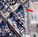
 It seems Google maps has upgraded their satelitte photo resolution lately. At one time, I could not get a good look at my neighbourhood (it was very low resolution). Not anymore. In fact, there's my next-door neighbour's car parked out front......
Can you find your house?

7 comments:
I don't live on the edge of the black hole anymore. they got a shot with out the cloud. but with the construction going on around me in marda loop I think this picture is a few months old. I'll look some more and see if I can date it.
Dvd
Oh, I know for a fact that the photo(in my area) is around 18 months old because the new Children's Hospital structure hadn't even been erected yet.
[snort] I said 'erect'.
I know the photo of my neighbourhood is old....there is no snow on the ground, everything is green and pretty, and the trees still have all their leaves.
I just zoomed in on my brothers house in Glendale Ca. and the resolution is better than it used to be I can zoom in to the max and pick out each of his cars.
Dvd
Nah, Still can't see my house, as a matter of fact I can't even see my neighbourhood. The street is mapped out, but the image just shows a vast wasteland, like the aftermath of a nuclear bomb. :D
The image google is using is still pretty old, considering we moved in October 2004 and ours was one of the last few houses built in the neighborhood.
To give you an idea, it's in the SW and I can walk to Spruce Meadows in about 10 minutes from my front door.
Looks like it is older than that. The deerfoot extention from 22x to the number 2 highway isnt even close to being open. So a minimum 24 to 30 months old. Maybe if it is a registered version you get more current images. Who knows.
JMathews
I don't have any kind of membership, but the photos (which are tiled - and not very well I might add - check out the Crowfoot area) were not all taken at the same time, as they represent different seasons. So it's probably an ongoing process and will likely improve over time.
Post a Comment